Paper to CAD drafting services, Architectural Maps, Mechanical & civil maps, Machine Drawings, Historical Archives, Construction documents
DimensionI CAD: Paper to CAD drafting Services Dimensioni
Home About Us Services Portfolio Procedure Guarantee Career Contact Us FAQs


SERVICES
Paper to CAD
Architectural
Arch Design
Interior & Exhibition
Urban Design
Engineering Design
CADD
2D
3D
GIS
Utility Mapping
Remote Sensing
AM/FM
Thematic Mapping
Contour Mapping
Parcel Mapping
Topographic Mapping
Image Processing
Gis Application Development
GIS Applications
  » Services > GIS > Disaster Management
Rural GIS   |   Health GIS   |   Municipal GIS   |   Disaster Management
Environment GIS   |   Transport GIS   |   Geology Mapping
Urban GIS   |   Facility Management   |   Business GIS Solutions

Disaster Management

Disaster can be managed well through spatial planning and one requires a GIS (Geographical Information System) for such a management.

  • Data on the disastrous phenomena (for example, landslides, floods, earthquakes), their location, frequency, magnitude, frequency and so on.
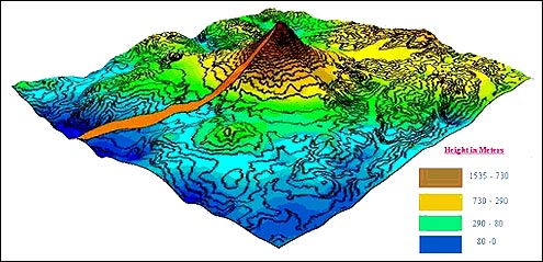
  • Data on the environment in which the disastrous events might take place: topography, geology, geomorphology, soils, hydrology, land use, vegetation and so on.
  • Data on elements that might be destroyed if the event takes place: infrastructure, settlement, population, socioeconomic data and so on.

« Back

Brief Requirements

DimensioniCAD - India's premier CAD & GIS services company.
Paper to CAD drafting services, Architectural maps digitisation India, Outsource microstation drafting work to India

Dimension I is the world's leading CAD services provider to Offshore AEC firms, real estate companies and municipal governments. We have completed over 1000 jobs across more than 20 countries covering different industries! Dimension I serves markets all over the globe through its offices in New Delhi. Our services are best-in-class and are backed by customer references. Please feel free to get in touch for a discussion.

© 1999 - 2010