Paper to CAD drafting services, Architectural Maps, Mechanical & civil maps, Machine Drawings, Historical Archives, Construction documents
DimensionI CAD: Paper to CAD drafting Services Dimensioni
Home About Us Services Portfolio Procedure Guarantee Career Contact Us FAQs


SERVICES
Paper to CAD
CADD
2D
3D
GIS
Utility Mapping
Remote Sensing
AM/FM
Thematic Mapping
Contour Mapping
Parcel Mapping
Topographic Mapping
Image Processing
Gis Application Development
GIS Applications
  » Services > GIS > Rural GIS
Rural GIS   |   Health GIS   |   Municipal GIS   |   Disaster Management
Environment GIS   |   Transport GIS   |   Geology Mapping
Urban GIS   |   Facility Management   |   Business GIS Solutions

Rural GIS

The Implementation of GIS technology in Rural development will help the government.

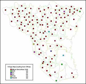
  • To provide the planners an accurate spatial view of the district at different levels such as district, block, village level as well as road and rail network, drainage network, e.t.c
  • To provide the planners detailed demographic data and education & health related data on desktop in a GIS environment
  • To assists the planners in finding out the possible locations for the schools and health centers depending on several parameters such as for health; population density, number of health centers required and its optimum location, number of disease infected persons etc. and similarly.


« Back

DimensioniCAD - India's premier CAD & GIS services company.
Paper to CAD drafting services, Architectural maps digitisation India, Outsource microstation drafting work to India