Remote Sensing

Remote Sensing is the science and art of acquiring information (spectral, spatial, temporal) about material objects, area, or phenomenon, without coming into physical contact with the objects, or area, or phenomenon under investigation. Without direct contact, some means of transferring information through space must be utilised. In remote sensing, information transfer is accomplished by use of electromagnetic radiation (EMR). EMR is a form of energy that reveals its presence by the observable effects it produces when it strikes the matter. EMR is considered to span the spectrum of wavelengths from 10-10 mm to cosmic rays up to 1010 mm, the broadcast wavelengths, which extend from 0.30-15 mm.
Types
1. In respect to the type of Energy Resources:
Passive Remote Sensing: Makes use of sensors that detect the reflected or emitted electro-magnetic radiation from natural sources.
Active remote Sensing: Makes use of sensors that detect reflected responses from objects that are irradiated from artificially-generated energy sources, such as radar.
2. In respect to Wavelength Regions:
Remote Sensing is classified into three types in respect to the wavelength regions
- Visible and Reflective Infrared Remote Sensing.
- Thermal Infrared Remote Sensing.
- Microwave Remote Sensing.
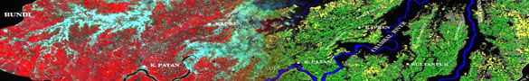
This technique may be the most effective way to collect the information. Aerial Photographs and Imagery carry huge amounts of analogue data. When interpreted, they can provide valuable information. This technique is helpful for environmental data, plan more detailed field investigations, discover certain classes of properties, map sites, locate and confirm the presence of predicted sites.
- PAN Images
- LISS III
- IKONOS
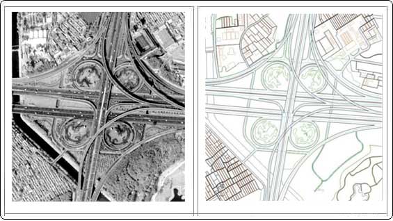 |
|
| Input | Output |